Vienna International Airport (VIE)
Driving Directions / Travel by Car
(Vienna, Austria)

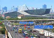
Providing essential air access to the capital of Austria and a variety of other Austrian cities, Vienna International Airport (VIE) lies around 20 minutes south-east of the city centre. The airport is situated just off the A4 Ost-Autobahn motorway, which is connected to a variety of other major roads in Vienna.
Signposted locally as the 'Flughafen Wien-Schwechat', Vienna Airport is especially close to Enzerdorf an der Fischa, Fischamend, Galbrunn, Klein-Neusiedl, Rauchenwarth and Schwadorf.
Directions to Vienna International Airport (VIE) from the north:
- From Strebersdorf, follow signs for the A22
- Head in a southerly direction along the A22 continuing straight on at every roundabout
- When you arrive at the last roundabout on the A22, turn right and follow signs for the A4 motorway
- Head south along the A4 until you reach the airport exit
Directions to Vienna International Airport (VIE) from the south:
- From Sieben Hirten, take the A2 and follow signs for the A23
- Join the A23 north and follow signs for the A4
- Head south along the A4 until you reach the airport exit, which is well signposted
Directions to Vienna International Airport (VIE) from the east:
- From Essling, take minor road 3 until it meets with the A23 motorway
- Head south along the A23 and follow signs for the A4
- Join the A4 and head south until you reach the airport exit
Directions to Vienna International Airport (VIE) from the west:
- From Weidlingau, take the A1 east until you meet the A23
- Take the A23 north, following signs for the A4
- Head south along the A4 until you reach the airport exit, which is signposted
We recommend that you allow extra time in your travel schedule for possible road delays on route to the Vienna Airport. Austria is a busy city and routes to the airport have the propensity to experience traffic jams during busy times of the day.
Vienna International Airport (VIE): Virtual Google Maps
 Providing essential air access to the capital of Austria and a variety of other Austrian cities, Vienna International Airport (VIE) lies around 20 minutes south-east of the city centre. The airport is situated just off the A4 Ost-Autobahn motorway, which is connected to a variety of other major roads in Vienna.